 |
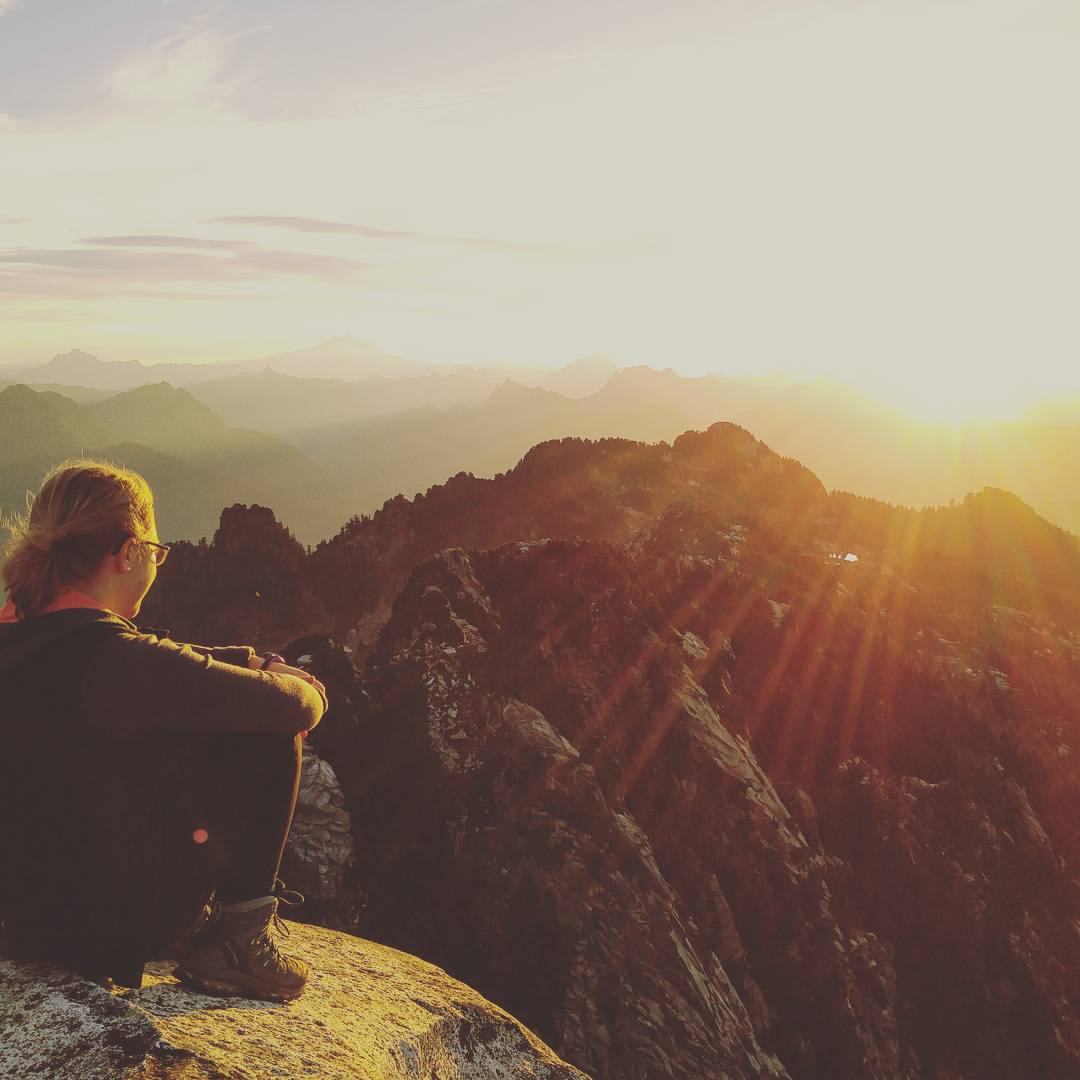
| Facing southeast at sunrise, Mount Pilchuck Summit 10/16/15 |
This mountain is best seen from downtown Everett on a clear day, appearing almost due east. The trail is accessed using a gravelly road, which often is plagued by potholes and minor washouts. All-wheel drive is usually not necessary, but a mid to high-clearance vehicle is encouraged. Because this 7-mile road takes you much of the way up the mountain's elevation--the trail starts at 3000 ft above sea level--the trek has an extremely high effort-versus-reward ratio. Probably the most well-photographed and popular hike of Mountain Loop Highway, Mount Pilchuck is certainly a stunner.
Though many a novice hiker has successfully attempted the summit, it is just as much treasured by more seasoned hikers and mountaineers. Those with minimal gear and experience should attempt this hike between June and late September, when snowfields covering parts of the trail are not prohibitive. However, during the winter months, reaching the lookout can be a welcome challenge for those who are prepared.
 |
| Climbing down the lookout in a snowstorm, Mount Pilchuck Summit 12/19/14 |
The Trail:
From the parking lot, the trail starts with an easy incline, a stroll through the woods. Cross several streams by rock-hopping, while staying vigilant of roots and mud. As you move into the Pilchuck State Park boundary, the incline increases to a slightly more heart-pounding one. At mile marker 1 (an orange marker that sticks up about eye-level) the trail becomes rather rocky and views of Everett and Puget Sound open up. This is when the trail becomes more steep and risky if there is snow or ice--it can be highly exposed and dangerous at times. Continue following the orange markers, past the remnants of the old ski resort that closed in 1980.
 |
| East side of the lookout tower, Mount Pilchuck Summit 3/6/15 |
Finally, the trail opens up to a clear shot of the lookout tower. For the last fifty feet it becomes rather less like a trail and more of a rough scramble up rocks and boulders. Take up your four-legged companions if you feel confident in their ability to climb over large obstacles and comfortable carrying them up the ten-foot ladder to the lookout tower. Otherwise, consider leaving them behind with a friend while you take a look at the 360-degree views the lookout allows. The lookout tower is open year-round.
On a clear day, the tower can provide views of most of the west side of the Cascades, from Rainier to the south to Baker to the north, along with Puget Sound, Seattle, Providence hospital in downtown Everett, and much more. For a comprehensive representation of the peaks you are looking at, there are maps labeling each peak on display inside the tower. It is certainly one of those "I can see my house from here!" moments.
Stats:
Difficulty--moderate-to-strenuous
Popularity--high
Mileage--5.4 round-trip
Highest Elevation--5327 ft
Elevation gain--2300 ft
Distance from I-5 in Everett--34.3 miles; 70 minutes
Major Peaks Visible: Glacier Peak, Mount Rainier, Mount Baker, Three Fingers, Whitehorse
http://www.wta.org/go-hiking/hikes/mount-pilchuck
http://rainsongpress.blogspot.com/2014/07/fifty-years-ago-at-mt-pilchuck.html
No comments:
Post a Comment